Şarköy; It is connected to the province of Tekirdağ and is adjacent to Malkara from the north, Marmara from the south, Tekirdag province from the north, and Gallipoli from the west. It has a surface area of 481 square kilometers. Olive growing in the coastal areas is highly efficient because it has a transitional climate between the Mediterranean and the Black Sea. Especially olive, tobacco, silkworm, sunflower and cherry production, especially in viticulture and seafood, has a very important place in the Turkish economy. Şarköy, one of the popular points in Tekirdag’s summer tourism, has recently shown a significant improvement in terms of tourist accommodation. Şarköy is also very suitable for windsurfing and water sports.
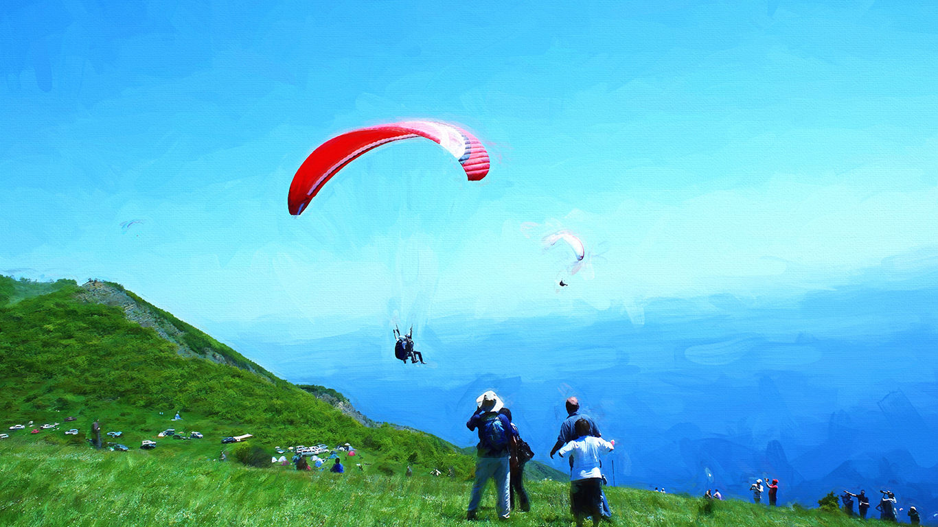
Uçmakdere is a village located in the Şarköy district of the province of Tekirdağ. It is located in one of the valleys of the Ganos Fault. This village, where the best quality grapes of Turkey are grown, is located behind Gaziköy. The village between Sarp rocks and the Sea of Marmara is one of Turkey’s most important paragliding spots. Flight is a frequent destination for paraglider lovers thanks to the weather conditions and the appropriateness of the hike. Flight from Nişantepe, 600 meters above sea level, ends at Ayvas in the sea level.
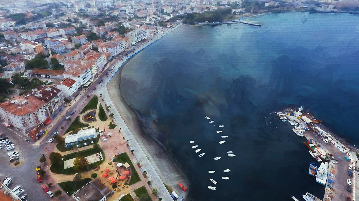
Kumbag; It is a small holiday village connected to the center of Tekirdag, located on the coast of Marmara Sea. It is located 14 km away from the center of Tekirdag. Kumbağ, known in ancient times as Kumbos; It is being used as a Greek fishing village in the Republican period, and its population has increased in time with the migration from Greece, Bulgaria and Romania. Despite being calm in the winter months, it is the point of frequent visit from Istanbul especially in the summer months. Thanks to the forest rest facilities and the sea on the Kumbağ ridges, it is very popular in the summer months.
Kastro is a promenade area 27 kilometers away from the Saray district of Tekirdağ province. Kastro, also known as Çamlıköy, is located at the junction of the province of Tekirdağ with the Black Sea. Located at the intersection of green and blue, the Kastro is located in the Istrancalar Region and has a rich vegetation cover. It is possible to take a boat trip in Bahçedere, 2 km from the sea. It is also possible to enter the sea thanks to the beach on the Black Sea coast. It is one of the important features that many rare plant coverings have.
Marmara Ereğlisi, a seaside town; Historical places, natural beauties and rock formations on the shoreline. B.C. The town, which is believed to have been established in the 600s, is known in history books as Perinthos and Heraclia. It was founded by Samosian colonists and was home to Greek, Roman, Byzantine and Ottoman states. In Marmara Ereğli, which has a Mediterranean climate, the summers are warm and dry; The winters are warm and rainy. The people living here lived; Fishing, tourism, agriculture, animal husbandry and industry.
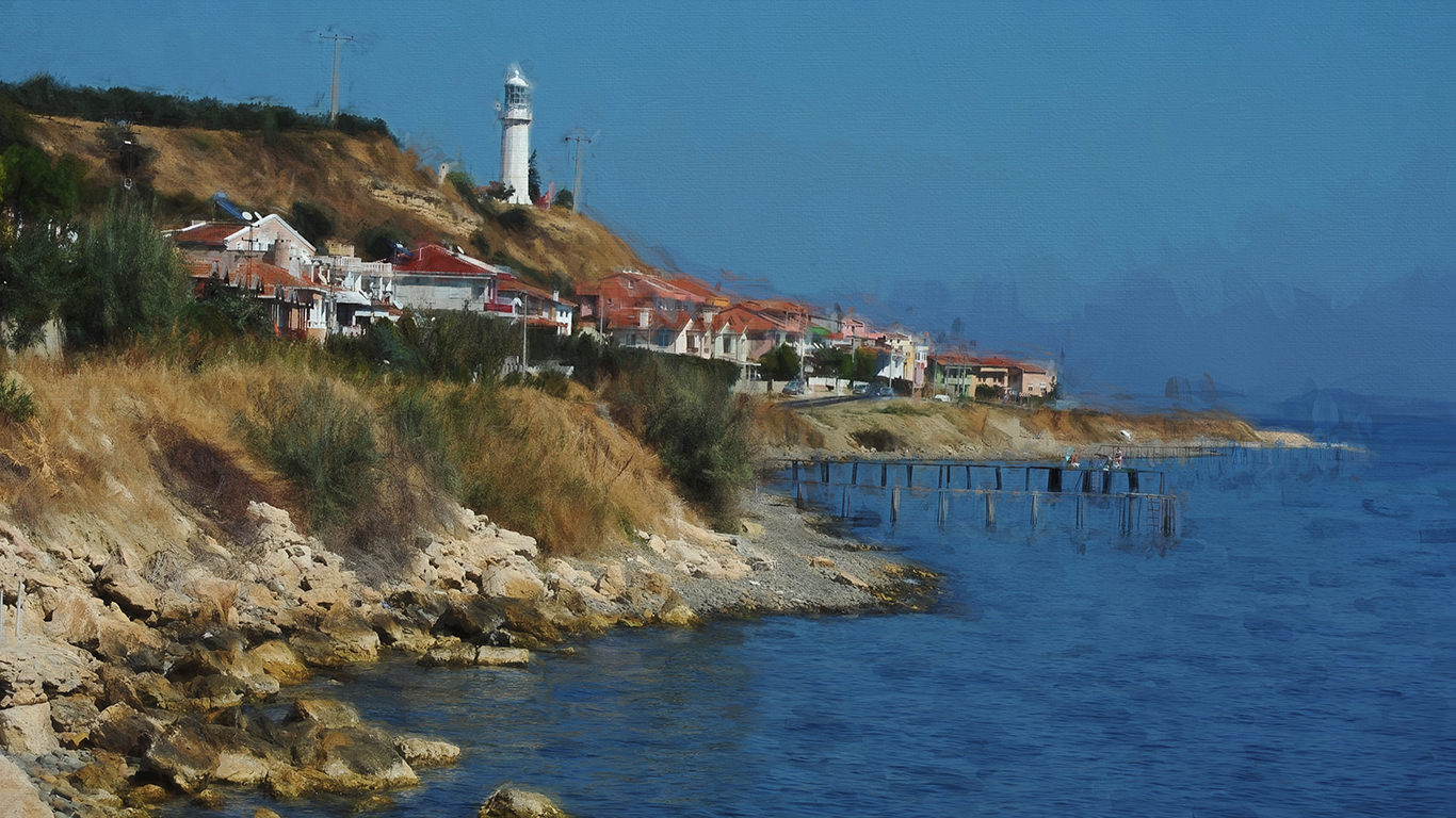
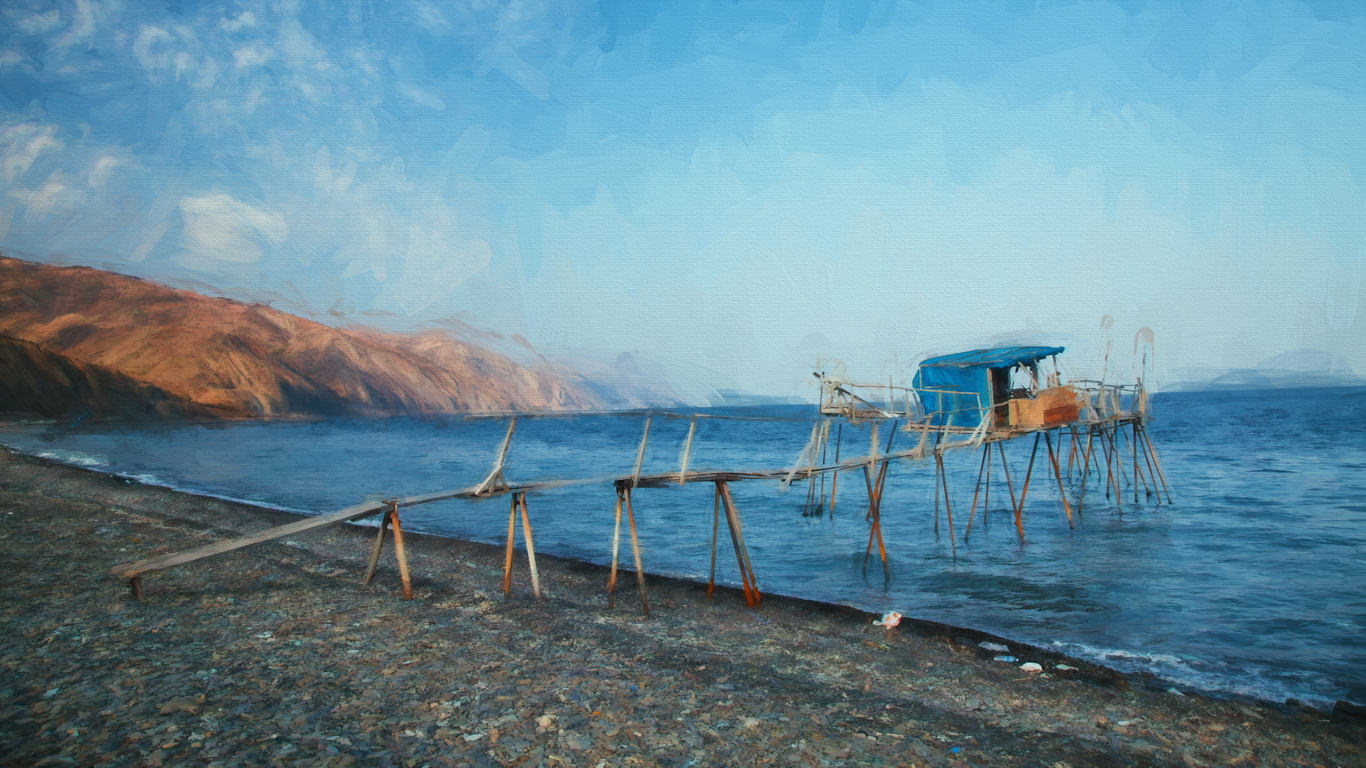
Gaziköy is a very old settlement located in Tekirdağ. Until 1923, he was the host of the Greek Cypriot people. After the Greeks, they live in Thessaloniki immigrants in Gazikoy. Gaziköy, which lies between the Marmara Sea and the Ganos Mountains, is also known as Ganos Village. In the village known for its natural beauty; Fishing, viticulture and olive farming are among the important activities. There are church remains and a marble fountain dating from the Ottoman period in the village where the traces of Greek and Ottoman cultures are found. Also located in Gaziköy; The wooden platforms that are built into the sea and built for fishing are quite remarkable.
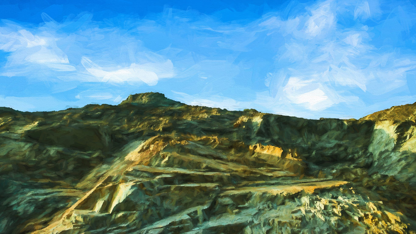
Mount Ganos, also known as Işıklar Dağı, is a mountain extending along the northern coast of the Sea of Marmara in Tekirdağ. The Ganos Mountain, extending in the northeast-southwest direction, is located in the Şarköy district of Tekirdağ and is the highest part of Tekir Mountains, which gives its name to the province of Tekirdag. The mountain, which has a height of 945 meters, is located at the 2nd Anatolian Mountain Belt in Geological Time. The name of the Ganos Mountain, which is the influence of the North Anatolian Fault Line in its formation, was taken from the ancient Ganos settlement located on the border of Gazikoy today.
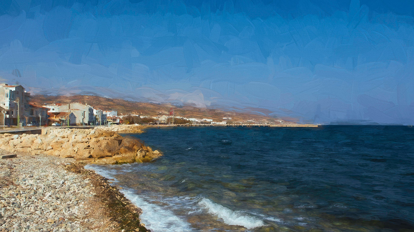
Mürefte is a neighborhood of Şarköy district of Tekirdağ province and is located at a distance of 227 km to Istanbul. The most important feature is the vineyards and the vineyard sector which develops on this basis. In Mürefte there are approximately 30 vineyard facilities, 5 of which are quite large.